Traffic Management Dashboard
City of Syracuse - Syracuse, NY
Markets utiltized:
Keywords
The Traffic Management Center (TMC) in Syracuse, overseen by the City’s Department of Public Works, is responsible for monitoring and managing traffic flow and transportation systems within city limits. A TMC operator's decisions affect the region’s traffic signals, intersections, roads, congestion, and reliability, as well as incident response during special events, emergencies, weather events, and crashes. Traffic management centers play a critical role in improving traffic safety, reducing congestion, and enhancing the efficiency of transportation systems by using data and technology to make real-time decisions and adjustments to traffic flow.
The Syracuse TMC team identified a need for a tool to incorporate multiple data sources into a user-friendly dashboard, improving their understanding of roadway requests and allowing the team to make better and faster data-informed decisions. To meet this need, JMT developed a web-based transportation dashboard for the TMC inside of the City's existing geographic information systems (GIS) environment.
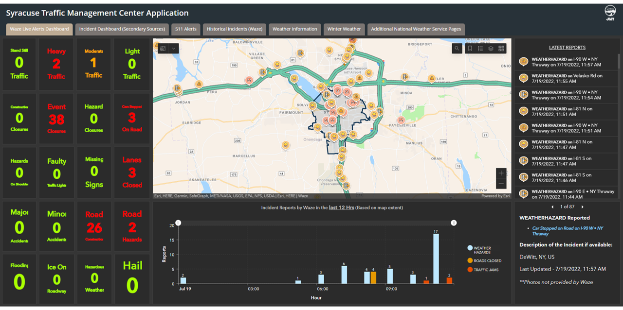
JMT Technology Group worked with TMC stakeholders, including the traffic center operators, to identify and innovate the requirements of the dashboard. Various data sources were evaluated for integration into the dashboard such as crowd-sourced data, historic data, near-real-time data, and real-time data. The dashboard was then developed and styled to create a thoughtful user experience that was tailored to the needs of the staff and designed to draw attention to the most critical traffic information.
The dashboard combines multiple feeds, such as data from the New York State Department of Transportation (NYSDOT) and Esri Traffic, to relay comprehensive metrics on events including accidents, road closures, and delays in transit. The incorporation of new technology in the form of Esri’s ArcGIS Velocity provides operators with real-time information on the location of city buses, and advanced techniques such as geo-fencing allow the buses to be ‘hidden’ when not in operation.
This project won the ACEC of New York 2024 Gold Award in the category of studies, research, and consulting engineering services.
-
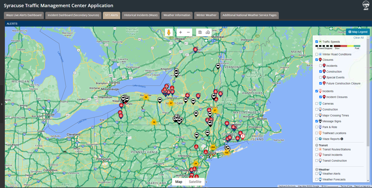
City of Syracuse Traffic Management Center Dashboard: 511 Alerts
-
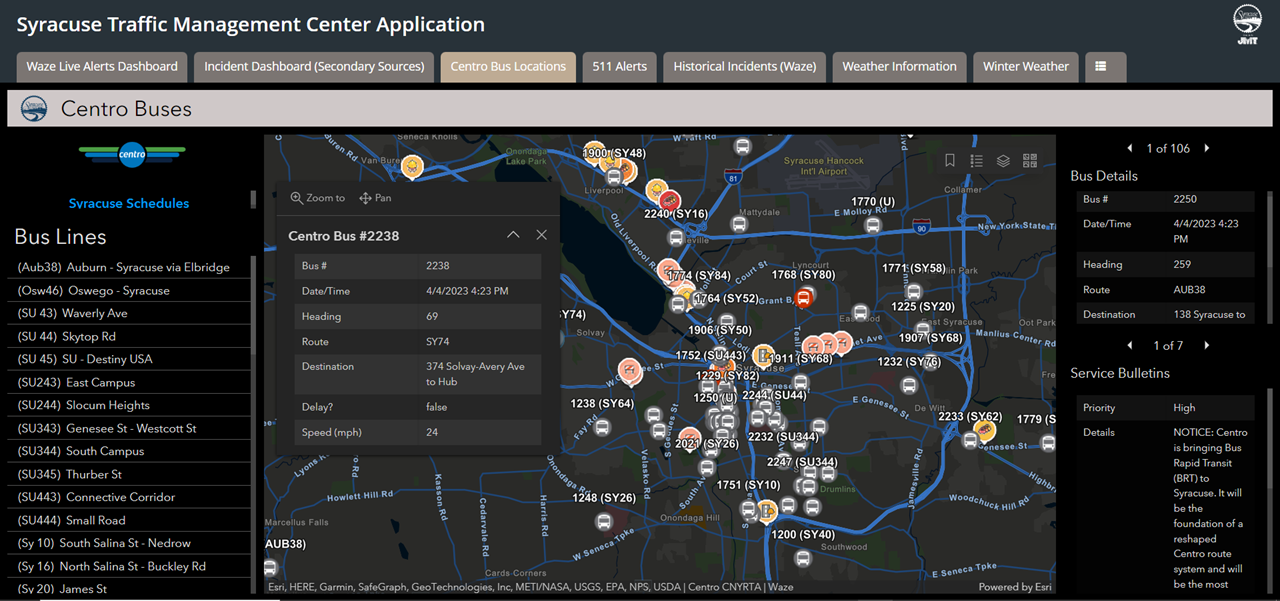
City of Syracuse Traffic Management Center Dashboard: CENTRO Bus Locations
-
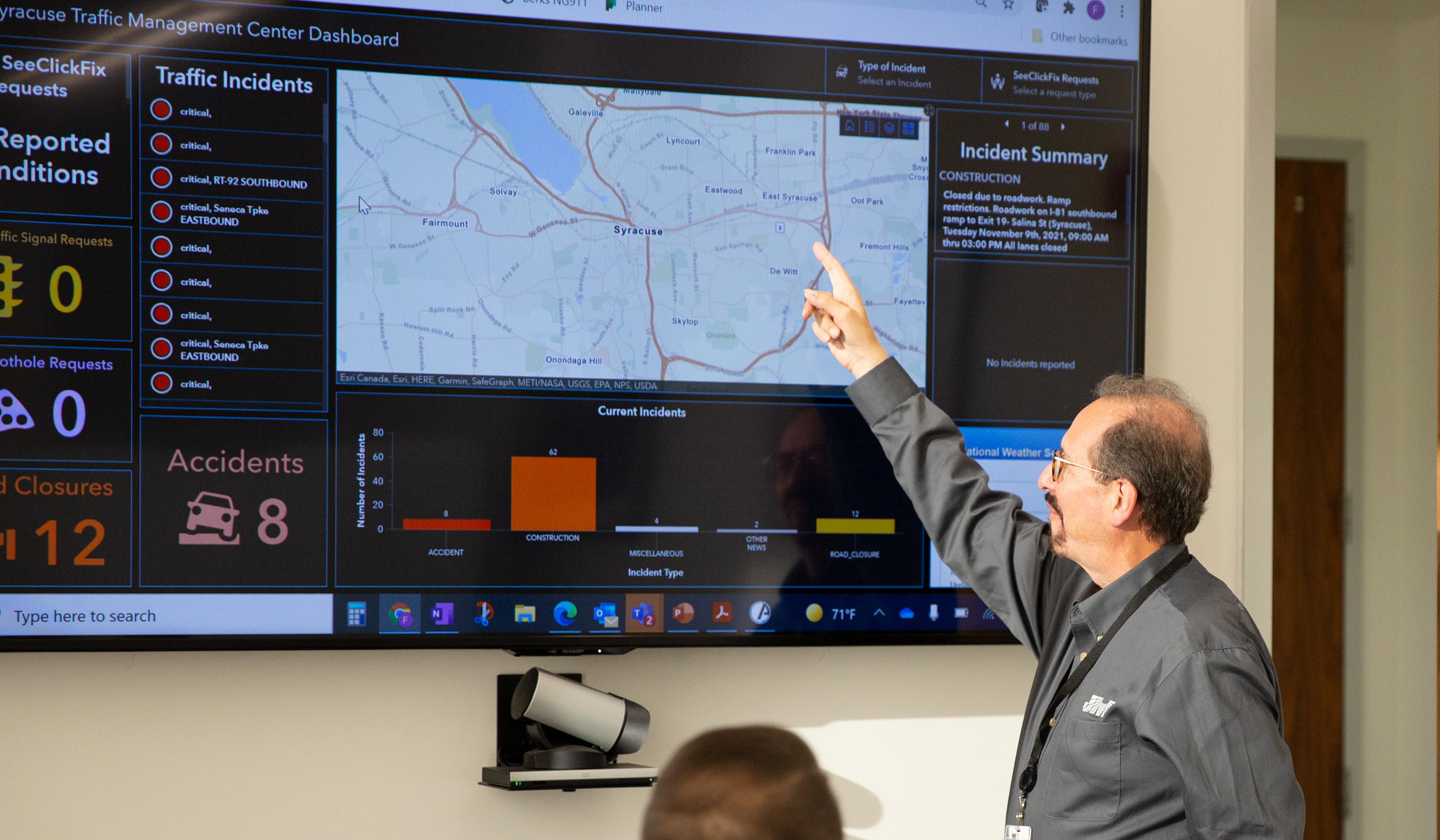
City of Syracuse Traffic Management Center Dashboard: Demonstration of Application Incident Dashboard
-
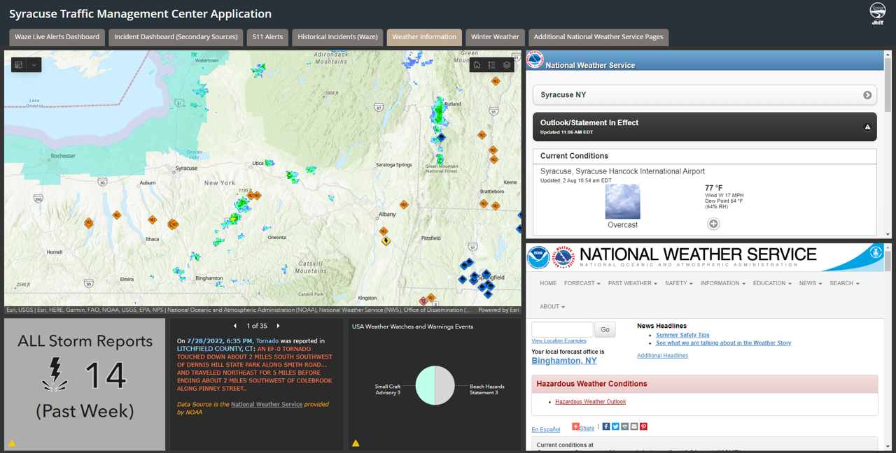
City of Syracuse Traffic Management Center Dashboard: Weather Information
-
City of Syracuse Traffic Management Center Dashboard: WAZE Dashboard
-
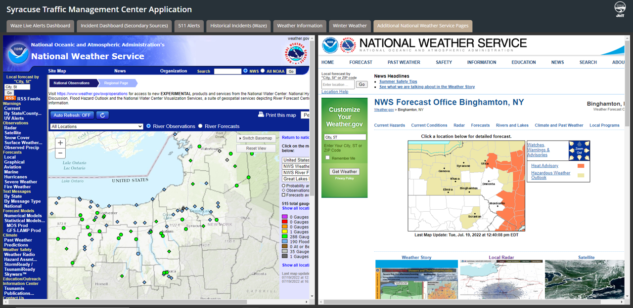
City of Syracuse Traffic Management Center Dashboard: Additional National Weather Services