JHU Homewood Campus Wayfinding Application
Johns Hopkins Facilities and Real Estate - Baltimore, MD
Markets utiltized:
Keywords
With the rich history of old brick buildings and their aesthetic atmosphere, navigating between classes and buildings across campus can sometimes be challenging. Tree cover can sometimes block satellite connectivity when using GPS guidance, making it difficult to find directions to certain buildings from a mobile device. In addition, not all historic buildings have the same amenities or accessible entryways, which may lead to challenges for some patrons with various mobility impediments. Understanding these challenges, Johns Hopkins University wanted to provide a solution to address outdoor navigation and include accessibility features for users. They aimed to maximize campus-wide usability, where students, faculty, and staff would have access to programs, facilities, and technology. The university began researching mobile app capabilities that would provide their community with an accessible and interactive experience with additional features for those with mobility impediments (such as crutches, canes, power chairs, wheelchairs, etc.)
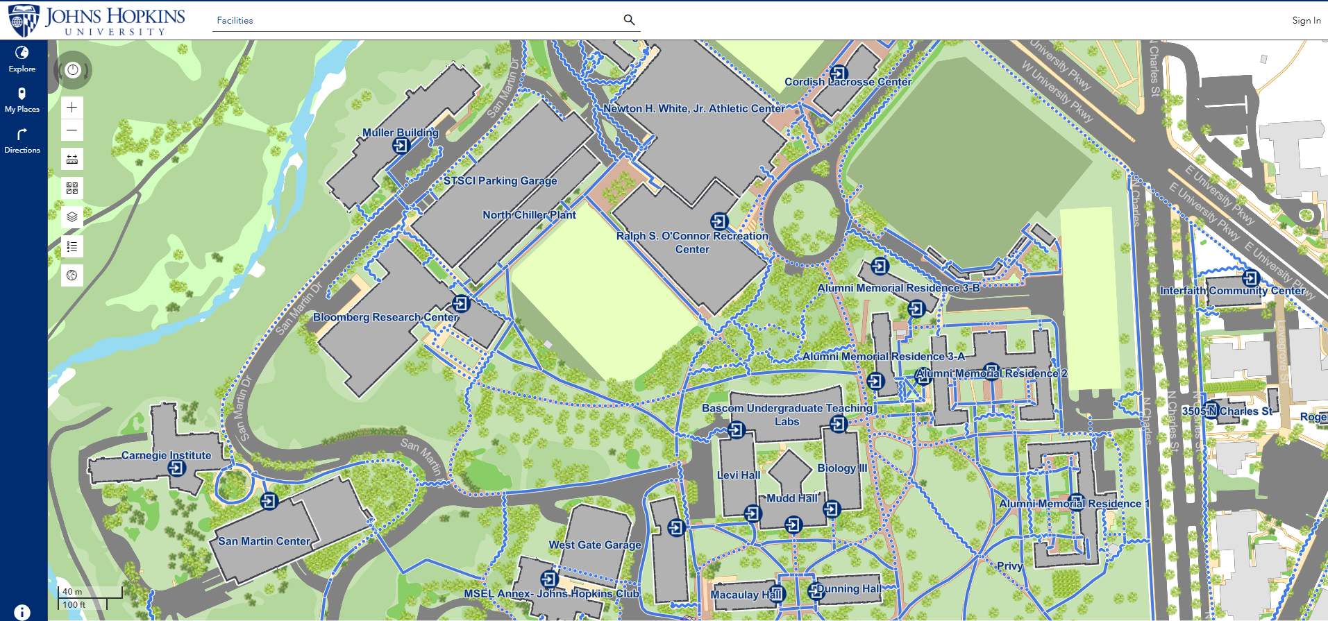
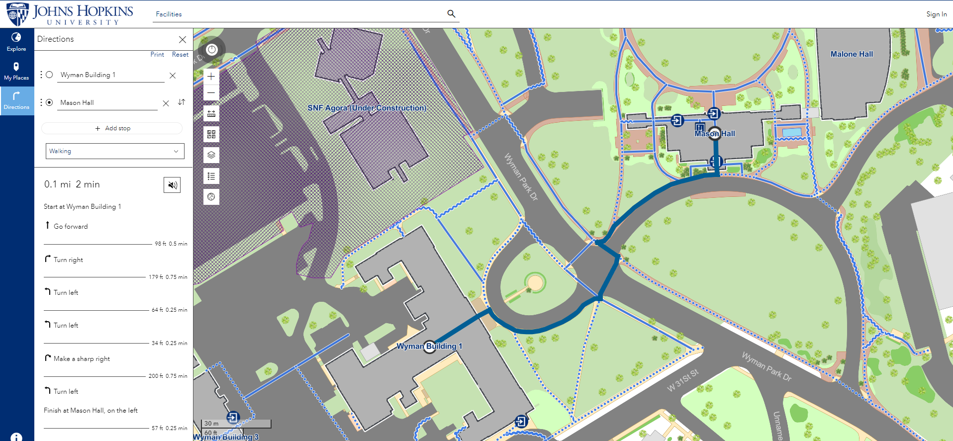
Johns Hopkins Facilities and Real Estate (JHFRE) engaged JMT Technology Group to develop a web-based GIS solution to support pedestrian wayfinding for travelers on the Homewood campus. The solution provides a route between locations based on the user's mobility mode, considering accessibility challenges at building entrances and along routes. They also wanted a solution that would support routing around temporary obstacles like road closures and construction fences, as these activities were also a challenge for campus visitors.
Over the next several months, JMT Technology Group worked with Johns Hopkins University to understand their data, users, and campus goals. With a focus on inclusive design and location intelligence, JMT Technology Group developed the JHU Homewood Campus Wayfinding App, a user-friendly mobile routing tool using Esri’s ArcGIS Indoors technology. The app featured turn-by-turn navigation and incorporation of route impediments.
JMT Technology Group leveraged the ArcGIS Indoors Information Model (AIIM) and GPS to create a wayfinding solution that included accessibility features to navigate across JHU’s diverse environments. The app included audio directions, various contrasted basemaps, and compatibility with mobile device voiceover technology. JMT Technology Group also adhered to the Institute for Human Centered Design (IHCD) recommendations, incorporating their rigorous accessibility standards in the app design process. JMT Technology Group and JHU partnered with IHCD to review all aspects of the app and conduct virtual and in-person user acceptance testing.
The new JHU Homewood Campus Wayfinding App was successfully introduced to campus students, faculty, staff, and visitors, providing a thoughtfully designed navigation solution for the Homewood campus. The application allows for real-time map updates to account for hazardous conditions such as construction areas and path closures when providing wayfinding recommendations. The app also includes workflows for collecting user feedback and issue reporting via Survey123.
The team actively collaborated with Esri staff to provide recommendations to enhance the software, addressing gaps like mobile app legends and custom messaging. It also introduced innovative features such as custom symbology to highlight accessibility levels and the use of elevators as navigational landmarks.
This project won the 2025 Esri Partner Award for the GIS for Good category.