Ataya Property Survey
Kentucky Fish & Wildlife - Kentucky
Markets utiltized:
Keywords
The Kentucky Department of Fish and Wildlife is placing a public access easement on 54,000 acres owned by The Nature Conservancy in southeastern Kentucky. As part of the easement process, JMT was hired to provide professional surveying services covering multiple tracts in Knox, Leslie, and Bell counties for The Commonwealth of Kentucky, Finance & Administration Cabinet, and the Kentucky Department of Fish Wildlife Resources. The process required a Baseline Documentation Report (BDR) and Environmental Site Assessment to be created; however, due to the vast and remote nature of the land, JMT Technology Group asked to develop innovative data collection methods and field tools that increased efficiency while in the field and compiling data into the report. Overall, 111 discrete locations were visited in the field, 600 photos were collected, and 26 map series were generated.
The BDR required desktop geospatial analysis as well as field data collection in remote areas. JMT Technology Group oversaw data collection and analysis tasks, configuration of Esri Field Maps integrated with Esri Survey123, Esri Survey123 reporting, implementation of Esri Location Tracking, use of GNSS Bluetooth receivers, configuration of a tracking dashboard and web map, and creation of an Esri ArcGIS Pro map series for report figure maps and a map package.
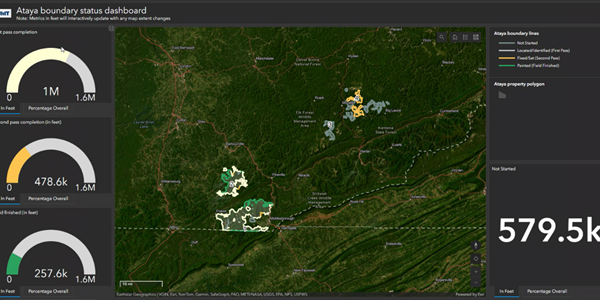
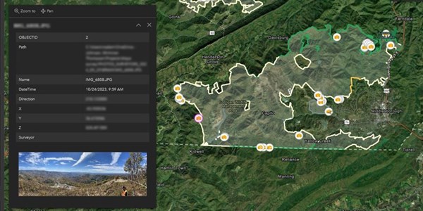
Additionally, to keep stakeholders well informed, a web application for surveyors and CAD technicians to record boundary survey progress was developed. This application feeds a dashboard that shares recorded project progress with the client based on three categories: first pass, second pass, and field finished. An incorporated georeferenced corner image was included in the interactive dashboard.

